|
|||||||||||||||||||||
|
Saturday, January 24, 5 hardy Ridenetters embarked on another of Neil's exploration runs in the Angeles National Forest. This is a trail ride created and marked by the national forest to give the riders (motorcycle, ATV, and 4X4 the maximum dose of scenery that the northern portion has to offer. Unfortunately, a portion of the Discovery Trail is presently closed to allow that portion of the forest charred in the summer wild fires to recover, but we were able to ride the majority of the trail, and probably what is the most scenic portion. The map I have included shows most of the trail, which runs all the way from the staging area in Rowher Flats nearly to SR-138 where it joins Interstate 5 near Gorman. Due to size limitations of my scanner, I had to clip off the portion of the trail that runs through Rowher Flats, but this was fine for the purposes of this article since the fire closure forced us to start our ride near the intersection of Lake Hughes, and Lake Elisabeth Road. (Point # 6 on the map below.)
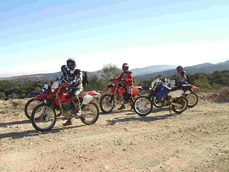
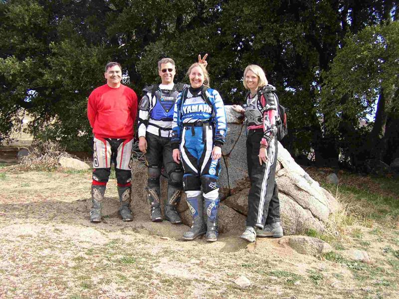
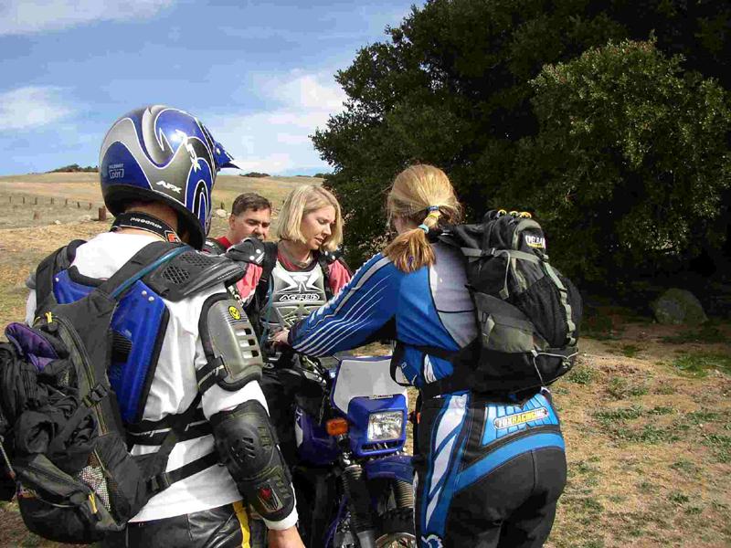
At this point, the beginning of the trail was a little difficult to find, looking a lot like a dirt road that passes next to a home on Lake Hughes Road. In fact the easiest way to find the trail is probably to go to intersection with Lake Elisabeth Road, then go south on Lake Hughes road about 200 yards while carefully looking for the trail marker on your right. The staging area is a very small area on each side of the road/trail, but was adequate for the four vehicles that we had. (Note that when the closed portion of the trail is reopened, riders will have to traverse a small section of paved road to connect to this part of the trail, which pretty much mandates dual sport motorcycles. Of course a legal spark arrestor and an Adventure Pass are also required.) For this ride, Lisa and I had ridden up together in her truck from Orange County, while Neil and Julie had driven up separately. We had a new rider on this trip, Tom, who was riding a very new and nice KTM 450 EXC. Tom drove up from Canyon Country, and was carrying his bike on a receiver-hitch carrier on the back of his Dodge Durango. After the obligatory introductions and necessary kidding around about who had the best cookies (I had brought some that my daughter baked this time, while the slacker Julie dared to bring the store bought variety.), we topped off the fuel tanks, checked the tire pressure, and donned our riding gear and packs for the adventure ahead.
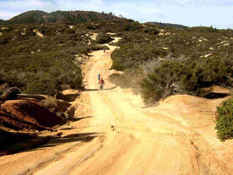
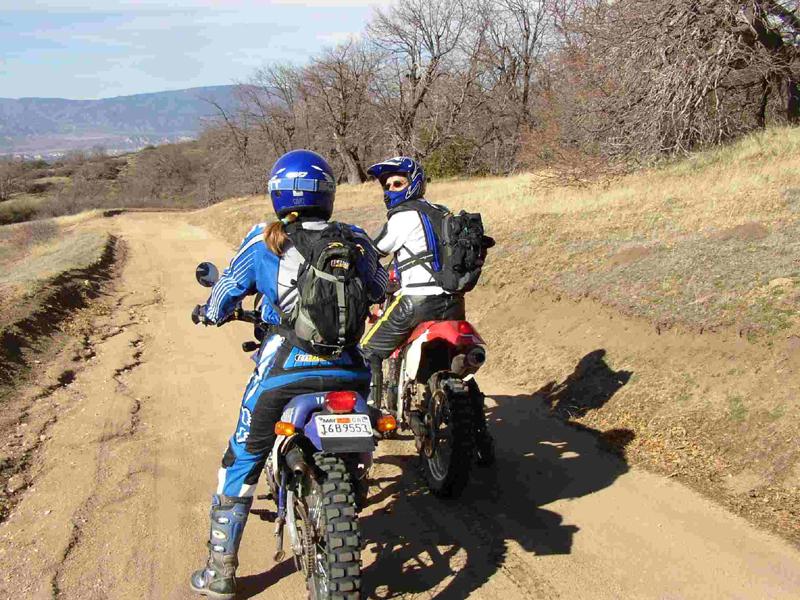
The trail immediately began to switchback up the side of Sawmill Mountain and as we climber ever higher the vistas began to unfold. Neil had done the ride once before and made no bones about it being mostly a scenery ride on a dirt road, but weather, scenery and visibility on this particular day more than made up for the lack of technical challenges. When Neil first made the trip was during our short November winter season, and the group he was with had not anticipated the fog and cold weather they were going to run into as the headed up the trail. They eventually wound up calling the ride off before any of their party started really suffering from exposure, but the weather on that trip made for a really long and cold trip home. The chamber of commerce must have ordered up the weather we were enjoying, because the skies were incredibly clear and cobalt blue, and the temperatures were in the 70's. An unexpected plus was the fact that the road was so hard-packed that there was very little dust kicked up by the rider ahead, making for an even more pleasant experience.
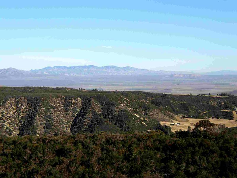
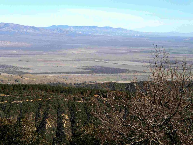
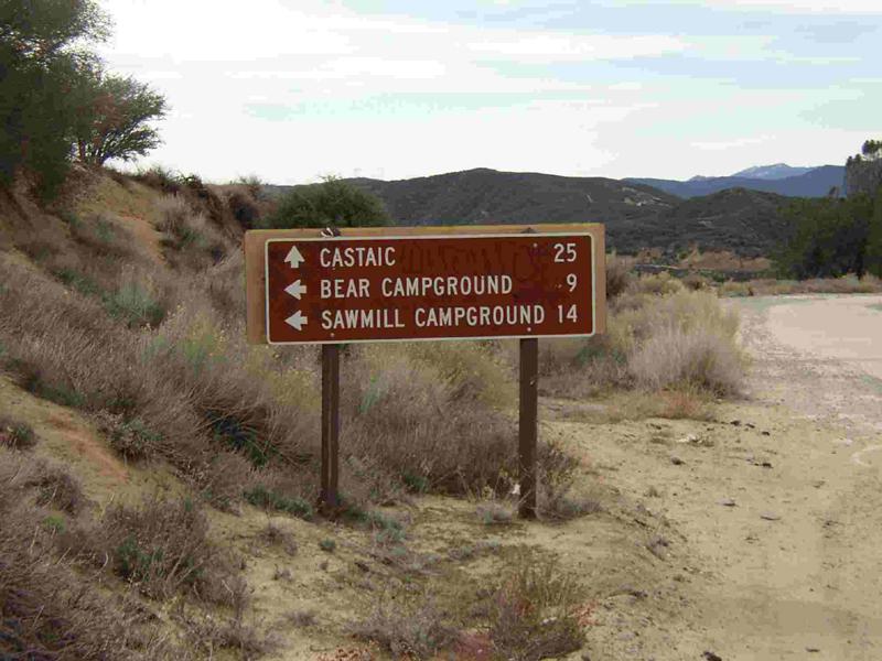
As we continued along we were treated to stunning vistas on both sides of the road, we had a view of canyon country to our left and vistas of the valley that SR-138 runs through as it heads north west from Lancaster to connect with Interstate 5 just below Gorman. This trail would allow a dual sport motorcyclist to ride all the way from Rowher Flat to the Hungry Valley SVRA while only having to traverse a few short sections of pavement. There were numerous campgrounds along the road that would allow (should I say encourage) a bike camping trip to explore the whole region.
As the trail twisted and turned we had views across the valley as far as Mojave where the huge farm of wind generators were plainly visible, and then as the valley narrowed we could plainly see the Tehachapi mountains, with Willow Springs Raceway in the foreground. I could also make out an area called Bean Canyon, where Dick and I used to go riding some 30 years ago. As I recall, the area had some forest trails, several large hill climbs, but the main pleasure of riding there was source of the area's name. Bean Canyon is a long, (10 to 12 miles long) winding, runoff-generated, canyon with gently sloping sides. One of my most thrilling riding experiences was starting at the top of that canyon and roaring down; climbing way up on the sides of the canyon and doing wall-of-death turns every time it changed directions. As I recollect the area was closed to riding shortly after we discovered it, but I will always fondly remember the riding there.
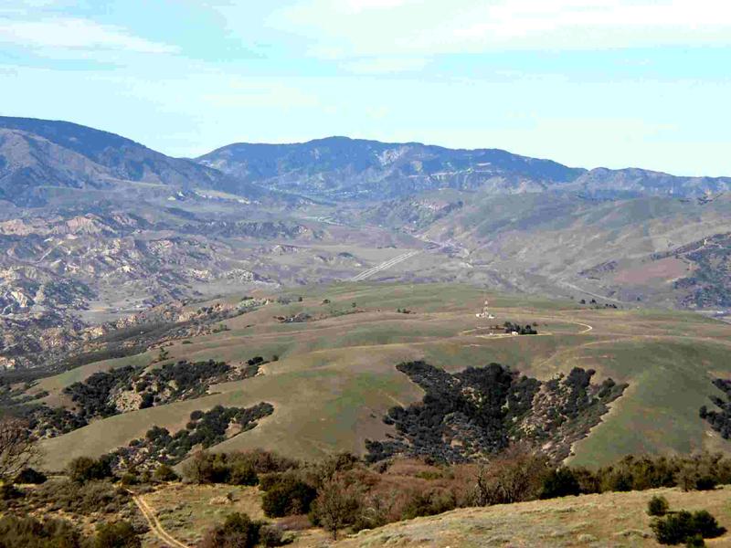
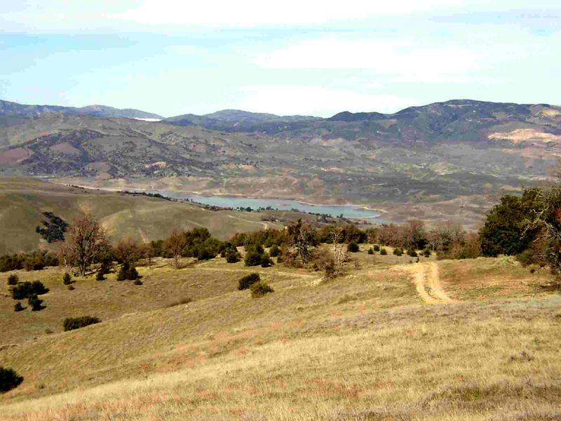
Were we now dropping off the mountain and into the valley that carries Interstate 5 north toward Gorman, the Grapevine Pass and into the California's massive central valley. On our left we could plainly see Lake Pyramid, while the scenery to the right was dominated by the Interstate as it climbed towards Gorman. We could make out Frazier Mountain beneath which sits Hungry Valley State Vehicle Recreation Area and in the background was the Los Padres National Forest. Looking a little more to the north and east the could see one of the generating stations and after-bay of the Feather River Project which brings water south to LA from the Sacramento and the Delta. We stopped below the huge Oak tree for a picture and I began to get the sense that Neil was in a peculiar mood indeed.
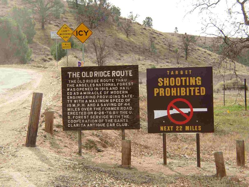
The road dropped inexorably down the mountain heading for the Old Ridge Route highway that used to carry all the traffic north and south until the Interstate was built, and was quite an engineering feat when it was first completed. Vestiges of the pavement can still be found along its route from Castaic all the way to SR-138. I was told that portions of the right of way are now fenced off due to damage done by the last El Nino. The final miles of the trail briefly take one down the old pavement and then drops us into a picturesque little valley that leads to Pyramid Lake in one heads south, but also heads north to its terminus at the very beginning of the Ridge Route.
We paused for a while and chatted with a resident that lives across the street from the trails end. When we asked about a good place in the area to have lunch, this very kind gentleman told us of a spring on his property and gave us permission to go there. After a little exploring, we never did find the spring, but found a nice meadow that Julie likened to the meadow in the Sound of Music Movie. We decided to stop there for lunch, and I'm told (I was caring for an extremely thirsty looking bush so alas we have no pictures) that Neil entertained our merry little band with his July Andrews singing and dancing in the meadow impression.
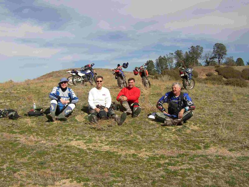
Enjoying a leisurely lunch, we discovered that Tom is a lawyer and had been riding for some time. He had ridden Enduros in his younger days and knew Larry Langley from his adventures there. Apparently, the girls had been discussing bikes and riding styles, with Julie noting that Lisa appeared to spend a lot of time on the pegs, while she felt uncomfortable with that position. She asked Lisa if she would check out her bike, and Lisa opined that the handlebars were probably not high enough for comfortable riding.
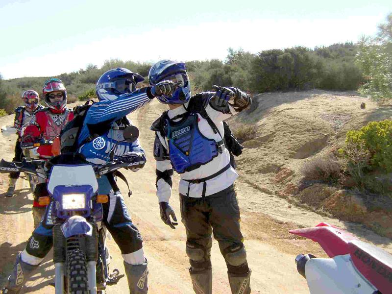
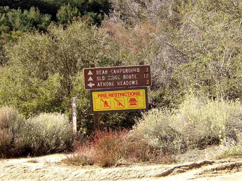
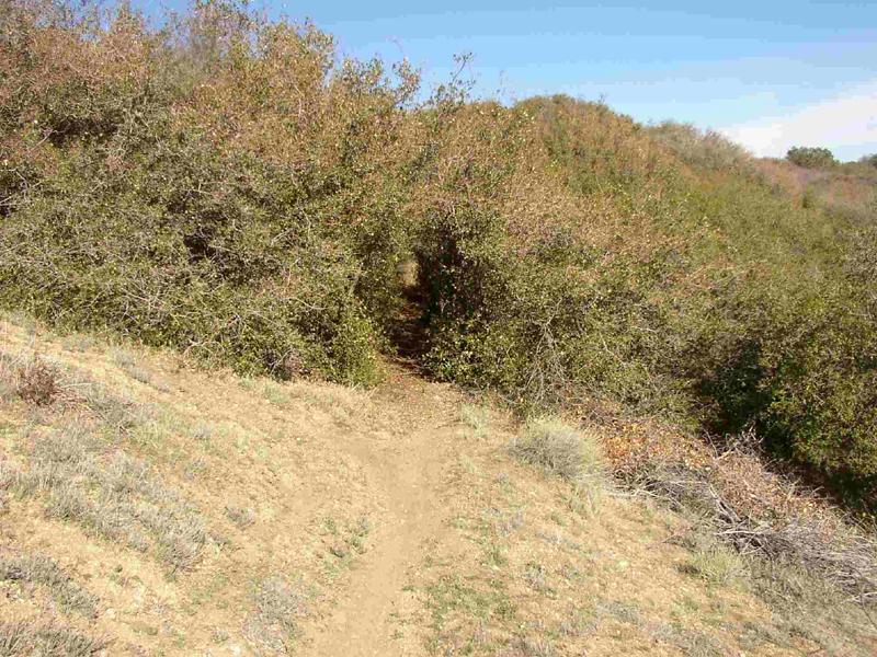
We had pretty much ridden the trail straight through on the way out, and decided to spend some time exploring the interesting looking roads and trails which lead away from the road we were on. After taking a few short but interesting two track trails, we met some riders who told us about a single track trail to the south of the road. I'm not totally sure about the legality of this trail, as it is not signed by the forest service, but someone spent a lot of time and effort cutting this trail through the brush, suggesting that the forest service may be developing it for formal use. At any rate, the trail was narrow and challenging, often cutting a tunnel through the surrounding greenery, and several times turning into a narrow track on the side of the hill. I was reminded of the upper end of Snowy Trail in the Los Padres, except that this trail is tighter and not as well used. It is definitely worth looking for if you decide to do the ride. While it is not formally signed, Neil and I feel it is relatively easy to find. Here are some directions that Neil put together that should help you find this trail. "On either side of the road 7N23 are 8-foot tall, telephone poles used as anchors for "gate'ing" the road closed. Coming from either side - from Lake Hughes or from the Gorman/Ridge Route side (it is closer to the Ridge Route though), you will see these poles (before the start of the track that we took, and "somewhere" close to the far end set - but I can't remember if it exactly before or after the far end set where we came out) - it is the only place on the ride that I saw which had these two sets of poles that could close off this section. Coming from the Lake Hughes side, when you pass the poles start looking for the "Left" entrance to the single track that starts as a dirt road and goes straight, but you have to veer to the right to pick up the single track."
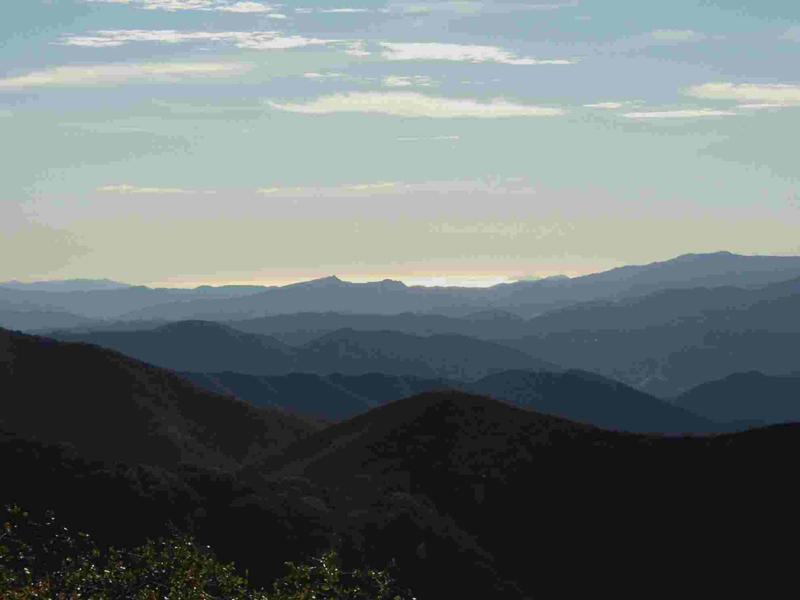
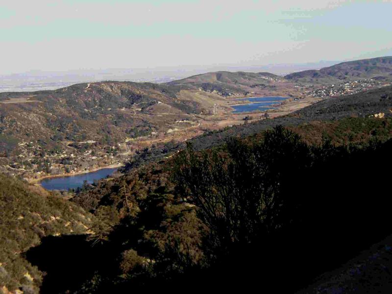
While it had started to cloud up a little and cool off during our lunch, the clouds blew through during our explorations, and we were treated to some really clear air and incredible visibility. At one overlook we were able to see all the way to the Pacific Ocean, Ventura and one of the Channel Islands when looking west, and turning east, we could see most of the Antelope Valley from Mojave down to Palmdale/Lancaster. Dropping down off the mountain toward our staging point, we were treated to a view of Leona Valley and both Lake Hughes and Lake Elisabeth. Arriving back at the trucks around 4 PM, we had plenty of time to load the bikes and finish the cookies. So ended another pleasant day of riding. Be sure and give this ride a try, you'll be glad you did.
|
|||||||||||||||||||||


|
Off-Road.com Newsletter Join our Weekly Newsletter to get the latest off-road news, reviews, events, and alerts! |
Follow @Off-Road
 Your Privacy Choices