San Sevaine Trail - Last Ride of the Season. OHV Volunteers Survey Trail After Fire
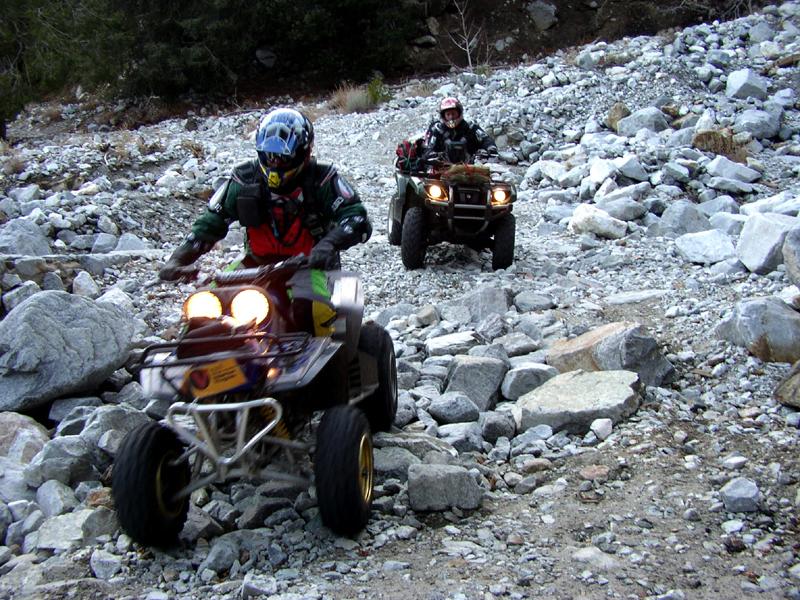
Dual Sport Ride
|
|||||||||||||
|
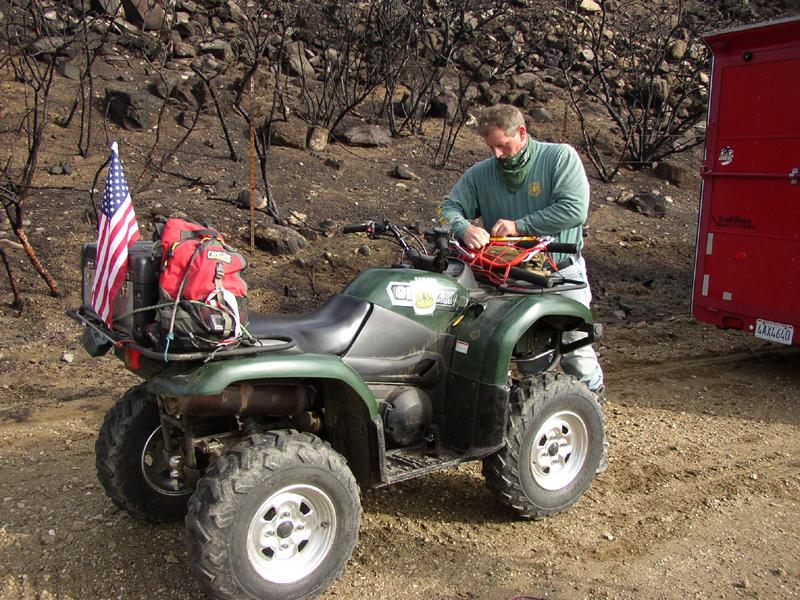
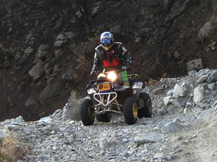
At any rate, since I
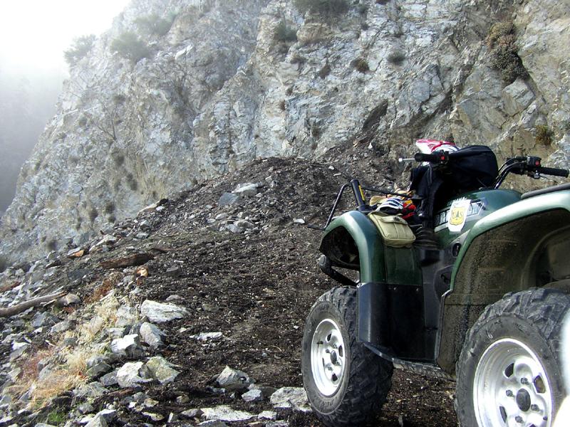
was on two wheels, and Mike Fellinger and Steve Schumacher were on quads,
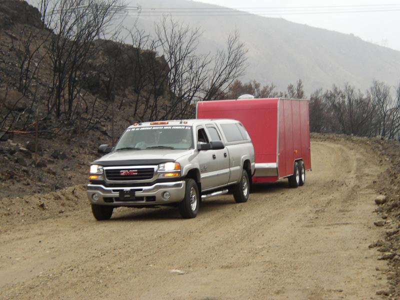
they drove Mike's brand new GMC Diesel 4X4 towing his big trailer to the
staging area just beyond the Lytle Creek Road gate, while I followed on my
bike. After unloading and preparing to ride, all the time punctuated with
some good-natured kidding, we set off to explore the trail and to close it
up for the season. The bottom portion
of the trail was in excellent shape due to the work that the fire crews
had done in fighting the fire. Just before we reached the microwave
repeater turnoff, we ran into Mike Rizzo and a friend who were also out
patrolling the trail. Mike patrols San Sevaine almost every weekend and
was amazed at the number of things that had been hidden but were now
visible because of the fire. He noted that there were several water supply
sites (wells, tunnels, aqueducts etc.) that he had heard about and was
finally able to find because the brush had been burned away. He told us
about the two fatalities that had occurred on the trail in recent weeks
because people had been able to get around the locked gates and get into
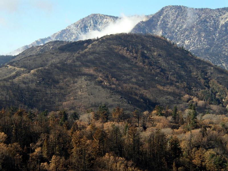
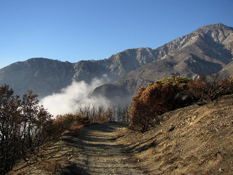
areas where they didn't belong. After our
conversation we continued on, passing through miles of desolation where
the fire had burned everything in its path. Interestingly, there were
areas that the fire had bypassed, either through a shift in the wind, or
because of some other quirk of nature. As we approached Joe Elliot
campground, we noticed that the wilderness area had not been spared, and
that the cabin that the Sierra Club had built was gone as well. When we
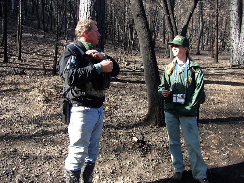
arrived at the campground, we noted a forest service truck in the parking
area, and soon came upon Jennifer, a forest service wilderness ranger who
was surveying the damage and making plans for remediation. Sadly, the fire
largely consumed the Joe Elliot pine, a huge old growth pine tree that had
been felled by lightening a few years ago. After checking out
the rest of the camp, we pressed on towards Calamity Canyon, a natural
drainage off Cucamonga Peak to which the trail clings tenuously. Because
of the loss of growth anchoring the soil above the trail, this area had
seen considerably washout activity, and the trail was obliterated in
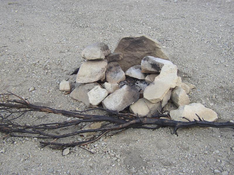
several locations. Along the way, we passed an illegal campfire ring that
someone had built right in the middle of the road. Even though there
wasn't much left to burn, we made quick work of the rock ring, tossing
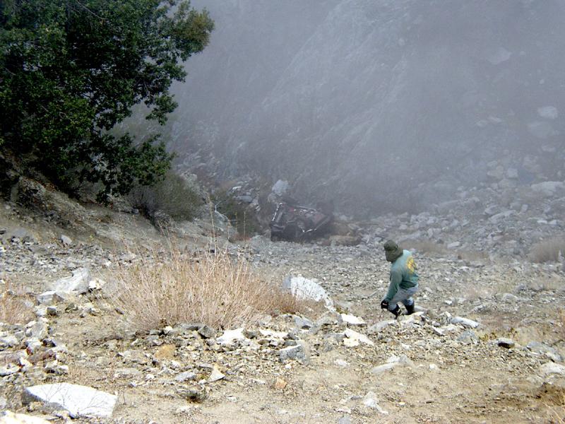
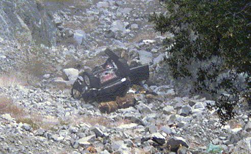
them over the side of the road. Further on, we came
upon the final resting place of a relatively new Toyota
4X4. Apparently the individual had driven around the closed gate in
Cucamonga Canyon and had been trying to make it across one of the washouts
in Calamity Canyon. Soil washing down from above had created a hump of
soft dirt and ash blocking the trail, and this individual had become
stuck, possibly high centering the vehicle. He had gotten out the jack and
was trying to lift the vehicle off the obstruction when it rolled over,
taking him down the canyon to his death. While we were not the first on
the scene, the accident was relatively recent, and there were still many
personal effects that littered the scene. Steve hiked down to
the wreck to take a closer look. Needless to say, this relatively new
vehicle was destroyed beyond repair, paying mute testament to the dangers
of being off road by oneself in an area that has been closed to the public
by the forest service because of the hazards that are there. It also shows
why they close an area right after a fire, to protect the general public
from the hazards and to protect the area from the general public. As I understand it,
this was not the only fatality on San Sevaine in recent months, and it may
not be the last as long as people keep driving around the gates closing
either end of the trail. This will probably continue to be a problem
because of the growth of the communities surrounding the forest and easy
access that the residents now have, due in no small part to the fire
burning away the growth that used to block the way. One wonders if this
incredible trail may have been so wounded by the Grand Prix fire that it
may never open again. While the adopting club, Scouts West, has not
commented on whether they will to undo the damage that unchecked runoff is
doing to the trail, recent pictures that I have seen show damage that
might require major earth moving equipment to repair. One picture, passed
around by Mike Rizzo at the Clash of the Titans, shows a 4-foot deep by
5-foot wide trench carved right down the middle of the trail by runoff
that normally would have been slowed and diverted by the surrounding
greenery. This coupled with the scorched and dead trees that will be
falling in droves over the next few years make reopening and maintaining
this particular trail seem almost overwhelming. With all of this on
our minds, we turned around with heavy hearts and headed back to where we
had staged. As we came to each gate, we closed and locked, knowing full
well that this might indeed be our last ride on one of the landmark trails
in the Southern California area. If our fears come to pass, we will surely
miss the incredible views of the basin that the Santa Ana winds bring.
Gone will be the panorama from Mount San Jacinto to Palomar, from Saddle
Back Peak to Catalina Island, and from the Palos Verdes Peninsula to the
downtown Los Angeles skyline. While we may truly
mourn the passing of this treasure of the forest, we at least will have
the satisfaction of having ridden it one last time, and of having seen
some of the things that had been hidden from us by the lush green growth
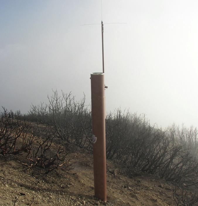
that had surround this trail prior to the fire. Around one corner was a
remote weather monitoring station (at least that's what I think it was),
that stood like a lonely sentinel, guarding a trail whose time may have
come and gone due to the wildfires of October 2003.
|
|
Off-Road.com Newsletter Join our Weekly Newsletter to get the latest off-road news, reviews, events, and alerts! |
Follow @Off-Road
 Your Privacy Choices